Aquatic projects
 Read more »
CYANOBLOOM
Advanced risk management tool for early detection and identification of toxic algal blooms.
- Duration: 2023 - 2026
- Customers/Partners:
European Union Anbiotek, Spain Sistemas Genomicos, Spain Water Insight, Netherlands Brockmann Consult, Germany Aclima, Spain
 Read more »
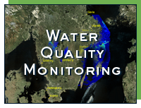
Water Quality Monitoring
Satellite products development for water quality monitoring in the Great lakes and coastal zone.
- Duration: 2006 -
- Website: http://www.vattenkvalitet.se
- Customers/Partners:
ESA - European Space Agency Lake Mälaren's Society for Water Conservation Lake Vänern's Society for Water Conservation Lake Vättern's Society for Water Conservation Northern Water Board Stockholm University Stockholm Water Company Strömbeck Consulting Swedish Environmental Protection Agency Swedish National Space Agency Swedish Water Authorities SYVAB Umeå University
 Read more »
CyanoAlert
Space Based Cyanobacteria Information & Service
- Duration: 2016 -
- Website: http://www.cyanoalert.com
- Customers/Partners:
European Union Brockmann Consult, Germany Odermatt & Brockmann, Switzerland ISS, Italy INCDDD, Romania InfoBaltic
 Read more »
GLaSS
GLaSS lays the foundation for water quality monitoring of lakes and reservoirs using the upcoming Sentinel-2 and Sentinel-3 satellites. GLaSS is an EUfunded R&D project within the Copernicus framework.
- Duration: 2013 - 2016
- Website: http://www.glass-project.eu
- Customers/Partners:
Water Insight, Netherlands Finnish Environmental Institute, Finland EOMAP, Germany Vrije Universiteit Amsterdam, Netherlands Brockmann Consult, Germany CNR-IREA, Italy Tartu Observatory, Estonia
 Read more »
Diversity II
The Diversity II project will contribute to the work of the Convention on Biological Diversity (CBD) by assessing biological diversity in two important ecosystems of the Earth, Inland Waters and Drylands using satellite data.
- Duration: 2012 - 2015
- Website: http://www.diversity2.info
- Customers/Partners:
ESA - European Space Agency Brockmann Consult, Germany Geoville, Austria CIBIO, Portugal
 Read more »
Monitoring of Lake Bolmen to support the water treatment processes
The project goal is to investigate, on a more comprehensive level, how satellite based information can be used to measure and monitor the water quality status of Lake Bolmen and to evaluate how changes in the water quality, observed from the satellite data, can be used directly to support and enhance adaptive operation at Ringsjöverket.
- Duration: 2012 - 2013
- Customers/Partners:
Sydvatten AB County Administrative Board of Halland County Administrative Board of Jönköping County Administrative Board of Kronoberg Swedish National Space Agency
 Read more »
WaterS
Strategic partnership for improved basin-scale Water quality parameter retrieval from optical signatures
- Duration: 2010 - 2014
- Website: http://www.mywaters.eu
- Customers/Partners:
Brockmann Consult, Germany European Union Finnish Environmental Institute, Finland Stockholm University Tartu Observatory, Estonia University of Tartu, Estonia
 Read more »
HISPARES
Spatial planning in archipelago waters by high spatial resolution remote sensing.
- Duration: 2010 - 2012
- Customers/Partners:
European Union Swedish Defence Research Agency University of Tartu, Estonia
 Read more »
Satellite-Derived Secchi Depth
Satellite-Derived Secchi Depth for Improvenent of Habitat Modelling in Archipelagic Areas
- Duration: 2010 - 2011
- Customers/Partners:
AquaBiota Water Research Strömbeck Consulting Swedish National Space Agency
 Read more »
High-Res Satellite Data for Mapping Benthic Habitats in Turbid Waters
The general goal is to investigate the possibilities to develop a method for classification and mapping of hard- and soft bottoms and different vegetation types in shallow coastal areas. The purpose is to derive information that will facilitate the environmental work and decision making for a number of authorities.
- Duration: 2006 - 2011
- Customers/Partners:
County Administrative Board of Stockholm County Administrative Board of Uppsala County Administrative Board of Östergötland Municipality of Norrköping SwAM - Swedish Agency for Marine and Water Management Swedish Board of Fisheries Swedish Environmental Protection Agency Swedish National Space Agency World Wide Fund for nature - WWF
 Read more »
High-Res Satellite Data for Mapping Depth and Maritime Objects
The general purpose of this project is to evaluate the possibility of using high resolution satellite data to collect information about a number of nautical objects and, to investigate to what extent the information collection process could be automated, to develop a strategy to include the satellite data in the existing nautical database at SMA and to test the developed strategy in a pilot production.
- Duration: 2007 - 2010
- Customers/Partners:
Swedish Maritime Administration Swedish National Space Agency